
A greenprint is a plan or tool that reveals the range of benefits natural infrastructure provides.
It is an adaptable, collaborative, strategic approach that engages partners and uses the best available science to identify multiple-benefit nature-based solutions for decision-makers. Greenprints identify diverse solutions to increase community and ecosystem resilience.
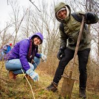
These solutions can range from conserving natural lands to protect drinking water to preserving working lands to support rural economies and restoring habitat to protect wildlife to expanding urban forests and designing parks to improve community health.
Greenprinting is an adaptable process that:
-
Highlights Environmental Concerns
Is broadly focused on the environment (conservation, land management, restoration, natural infrastructure, nature-based solutions, etc.)
-

Engagement and User-Centered Design
Greenprints incorporate engagement and user-centered design.
-
Stimulates Multidisciplinary Support
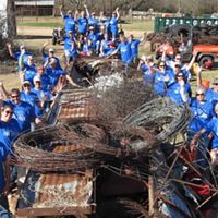
By creating greenprints, participants and advocates across sectors can gain knowledge and insights to make informed decisions, contribute to environmental conservation, and work toward a more sustainable and resilient future.
-

Wide Range of Benefits
Assesses and highlights multiple benefits and trade-offs to help maximize effective investments in conservation and natural infrastructure.
-

Place-Based Analysis
Includes place-based analysis of spatial data representing the best available science.
-

Helps Translate Data
Includes interpretation and storytelling that helps translate data so that it is accessible regardless of expertise.
-

Implementation-Oriented
Is implementation-oriented and designed to facilitate decision-making.

Greenprint process definitions
Examples
-
“Regional greenprint” means a plan that identifies natural lands, water resources, urban habitats, working lands, and recreational and other open spaces that conserve ecosystem values and are integrated into communities and growth strategies.
-
A greenprint is a government’s or community’s environmental plan, especially one concerned with parks, forests, waterways, greenways, and other shared spaces.
-
Greenprinting is the creation of conservation scenarios that help communities make informed decisions. Greenprinting can galvanize public support and encourage partners to work toward common conservation goals.
-
A web-based map tool that can help institutionalize conservation in infrastructure and land use agency plans, policies, and projects, resulting in an affinity for and protection of the natural and agricultural resources in a region. Read more.
-
A set of tools to guide voluntary land conservation and stewardship; a process to identify opportunities to meet multiple goals; a way to prioritize areas for voluntary, market-based conservation. Read more.
-
A “Greenprint” is a map at any scale that identifies conservation priorities based on best available science.
-
Greenprinting is a systematic approach for identifying areas that offer the highest conservation benefit for water quality protection and other regional resource priorities.
-
A greenprint is a non-regulatory vision to help communities make informed decisions about land conservation, scenic values, and recreation priorities. Read more.
-
The Bay Area Greenprint brings together a wide range of data to help you discover and highlight the overlapping benefits from the non-built environment including:
- Biodiversity
- Habitat
- Agriculture
- Water
- Carbon
- Recreation
-
Greenprinting uses land conservation to steer growth around important land and water resources and toward existing infrastructure.
-
The 2015 Cuyahoga County Greenprint is a set of mapping and planning tools. Read more.
-
Greenprint is a community plan developed and implemented by all. Greenprint is not a Miami-Dade County government plan. It is a community plan for all residents, organizations, and businesses. Read more.
-
It is intended to serve as a guide for voluntary land conservation with willing landowners and ensure that future conservation investments are strategic, cost-effective, and representative of community values. Read more.
-
The SJV Greenprint provides a regional tool to find multiple-benefit solutions, reduce conflict, and achieve an economically and environmentally sustainable future for the Valley, as a whole. Read more.
-
The Santa Clara Valley Greenprint establishes priorities and goals for protecting wildlands, conserving water resources, sustaining agricultural lands, and providing recreational and educational opportunities in the coming decades. Read more.
-
A plan that identifies strategically planned and managed networks of natural lands, working landscapes, recreational and other open spaces that conserve ecosystem values and functions.
-
A unified vision for a region-wide network of greenspace areas including parks, greenways, byways, blueways, conservation lands, natural areas, wildlife management areas, open space areas, and other similar spaces. Read more.
-
The Texas Hill Country Land, Water, Sky, & Natural Infrastructure Plan highlights where protection of these resources is most needed, and identifies opportunities for improving recreational access to nature and mitigating urban heat island impacts. Read more.